 |
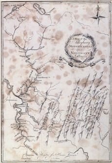
| Figure 1 Thomas Wightman, “A Map of the Alleghany, Monongahela and Yohiogany Rivers,” 1805. This map is from the Journal of a Tour in the Territory Northwest of the Alleghany Mountains Made in the Spring of the Year 1803 by Thaddeus Mason Harris. It shows the Monongahela Valley, Clarksburg, Morgantown, Greensboro, New Geneva, and Pittsburgh. (Duez Collection.) |