 |
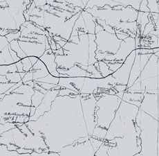
| Figure 10 Detail, “A Map of the District of Edgefield,” December 1816, by Thomas Anderson, D.S. (Courtesy, South Carolina Department of Archives and History, Columbia.) This map was later revised and published in the Robert Mills Atlas of the State of South Carolina (1825). The circled areas show the [Abner] Landrum pottery, CH [Edgefield Courthouse], the Rev. Jn. Landrum pottery, and Big Horse Creek. |